
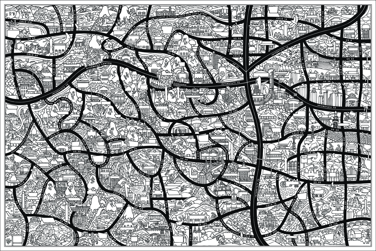
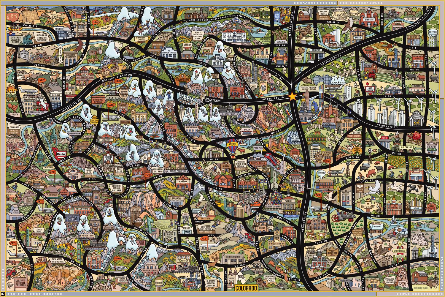
The Highest State in Illustration and Design. Commissioned by the Colorado Office of Economic Development and International Trade (OEDIT) for use as a 4 feet (high) by 7 feet (wide) backdrop in a trade show booth used to promote group travel in the state.
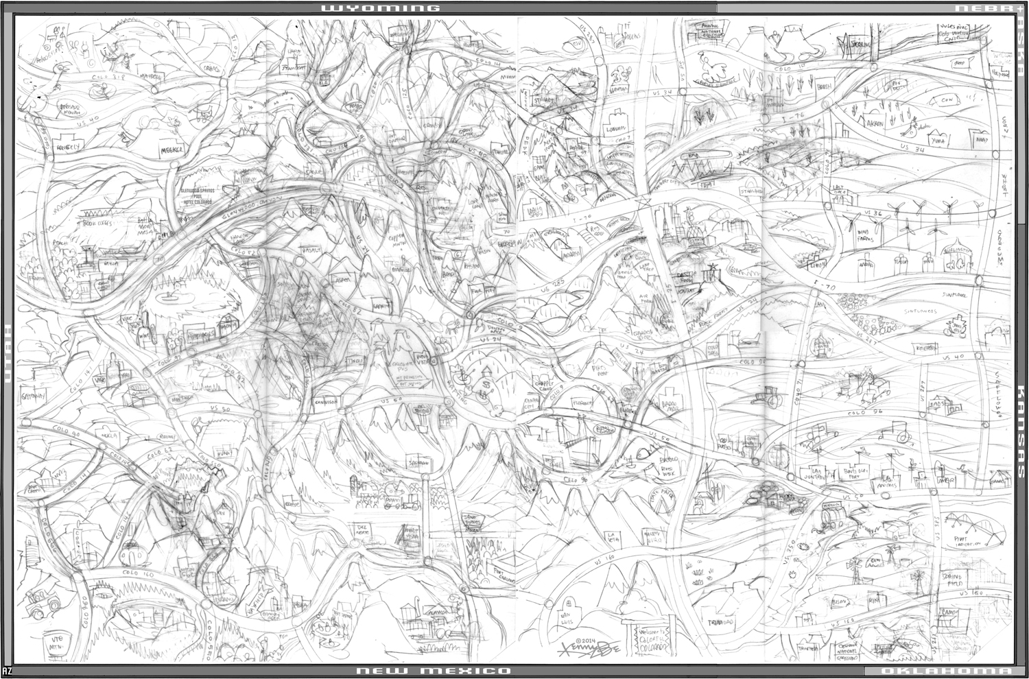
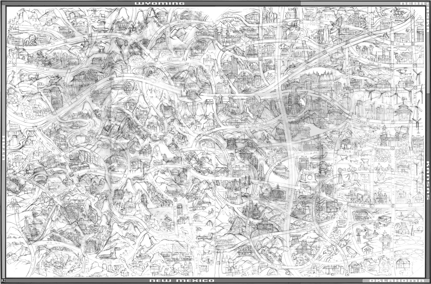
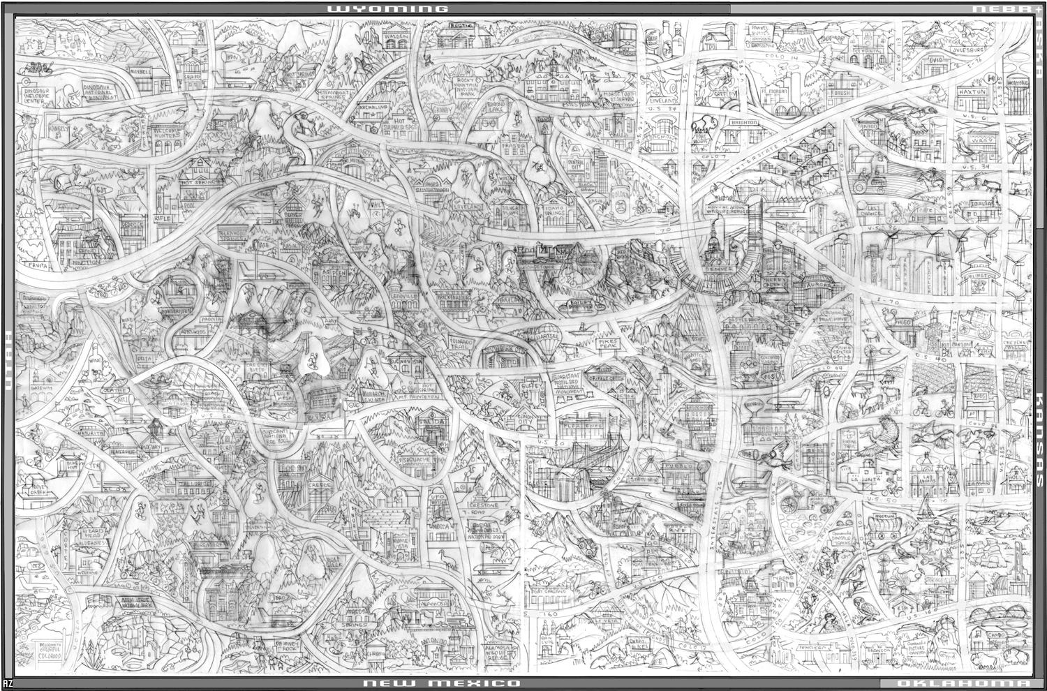
The Colorado Picture Map slide show above features the five of the eight different phases of the drawing, from initial sketch to final color. Each iteration of the drawing was drawn on tracing paper over the preceeding sketch. With each phase of the drawing, the landmarks were refined (And added and subtracted), and spacial issues were resolved with the streamlining of roadways and moving of mountains.
The Colorado Picture Map will be on display at the Kenny Be exhibit at the Denver County Fair on July 31, August 1 (Colorado Day!) and August 2, 2015. Colorado Picture Map Prints, greeting cards and back-to-school folders will be available for sale.